Apostle Anchor is an iOS app for cruising Apostle Islands National Lakeshore — 21 islands on Lake Superior where the evening's big question is always the same: given the forecast, where do we stay tonight?
🧭
Real shelter profiles
Every place carries a 16-direction shelter fingerprint and wave-fetch map built from its actual geography — bluffs, sandspits, breakwalls, and the islands that block a sea from building.
🌙
Overnight-weighted scoring
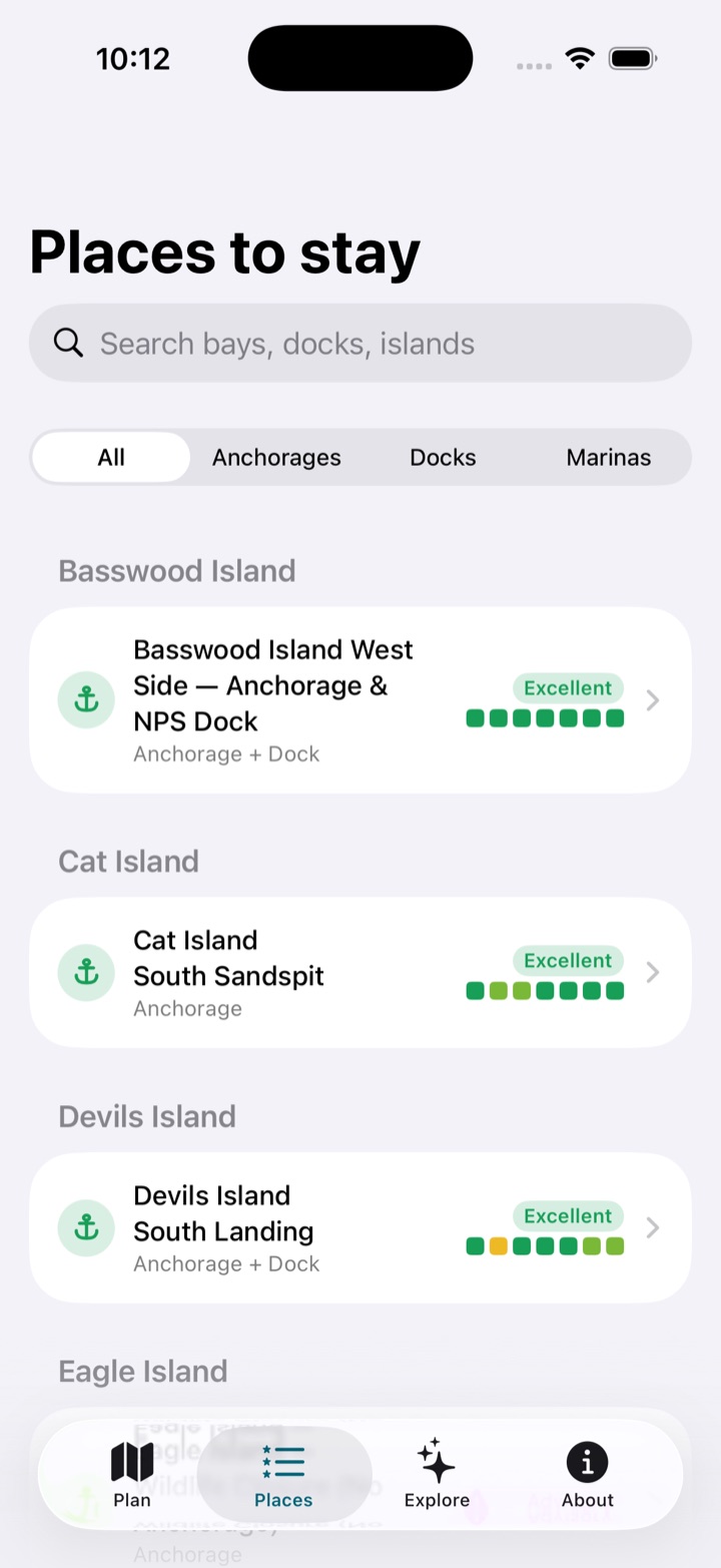
Hourly wind and gust forecasts are scored against each profile, weighting the hours you actually swing at anchor and grading every night from Excellent to Avoid.
⚠️
The lee-shore rule
Strong wind onto an exposed shore caps the score no matter how nice the beach is. Superior forgives many things; a lee shore isn't one of them.
🗓️
Multi-night stays
Pick 1–7 nights and every place is ranked across the whole window, worst night weighted heaviest — plus live buoy reality checks and a wave layer.
Explore every anchorage, dock & legend
The app's complete catalog on one chart — 98 documented places and lore sites, straight from the same database the app ships with. Tap any pin for the full story. (Live wind, waves, and night-by-night ratings live in the app.)
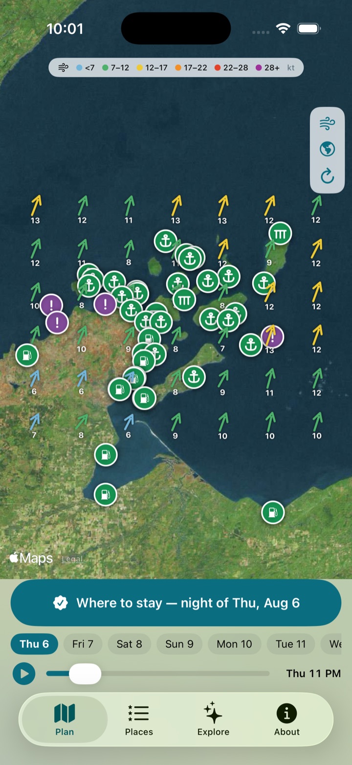
A live wind-field map with a play-through time scrubber, ranked picks for any stay length, protection roses on every anchorage, live NDBC buoy comparisons, marine alerts from NOAA — plus all the island stories for the days you're not going anywhere.
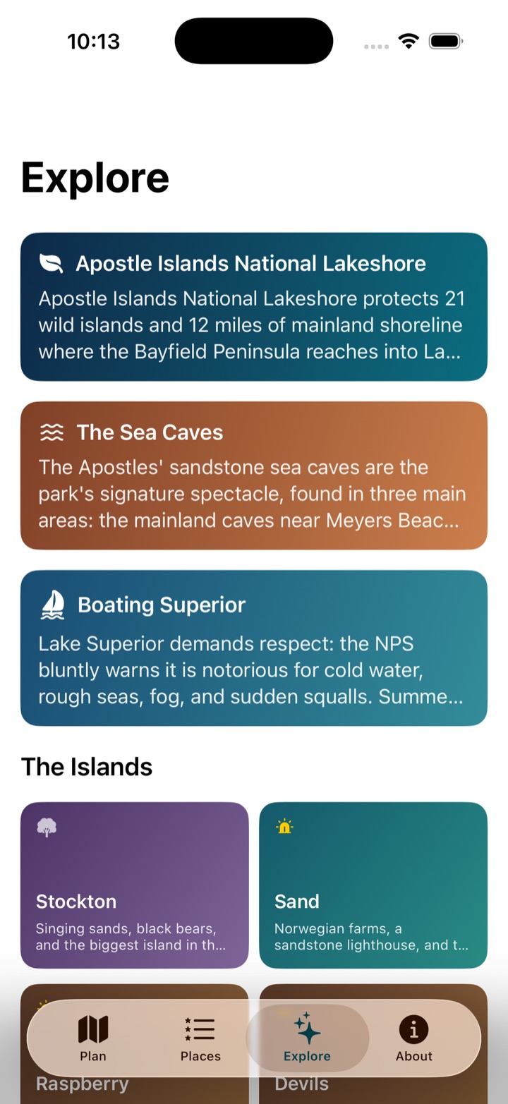
Wind-field planning mapEvery place, rated per nightIsland lore & lighthouses
The catalog
44 documented places — no invented pins on random coastline. Compiled from NPS boating guidance, marina listings, NOAA Coast Pilot, and published Lake Superior cruising references, then adversarially verified for existence, coordinates, and shelter geometry. Purple advisory entries are closures and day-stop-only areas the app will never recommend for the night.
Basswood Island
Basswood Island West Side — Anchorage & NPS DockAnchorage + DockQuick easterly-lee overnight nearest Bayfield
Cat Island
Cat Island South SandspitAnchorageQuiet middle-islands spit, either-side lee
Devils Island
Devils Island South LandingAnchorage + DockCalm-day sea-cave expedition base (dock closed 2026)
Eagle Island
Eagle Island — Wildlife Closure (No Anchorage)AnchorageAdvisoryAvoid — seasonal 500-ft wildlife buffer and shoals
Gull Island
Gull Island — Wildlife Closure (No Anchorage)AnchorageAdvisoryAvoid — year-round bird sanctuary and 2-ft ledge
Ironwood Island
Ironwood Island South SandspitAnchorageSolitude on a picture-perfect spit
Madeline Island
Big Bay (Madeline Island)AnchorageSettled-westerly beach day off the state park
La Pointe Special Anchorage (Madeline Island)AnchorageTown anchorage a dinghy ride from La Pointe
Madeline Island — La Pointe
Madeline Island Yacht ClubMarinaIsland-side full-service base by La Pointe village
Manitou Island
Manitou Island Fish Camp DockDockFair-weather history stop with real depth alongside
Michigan Island
Michigan Island Lighthouse Dock & AnchorageAnchorage + DockPerfect-weather double-lighthouse stop
Oak Island
Oak Island South SandspitAnchoragePick-your-side spit in shifting winds
Oak Island West DockDockNE-blow dock stop with the best hiking in the park
Otter Island
Otter Island Southeast Dock & SandspitAnchorage + DockNW-blow refuge with a sandspit campsite
Outer Island
Outer Island Lighthouse Dock (North End)DockSettled-weather lighthouse pilgrimage
Outer Island South SandspitAnchorageRemote dune anchorage in settled weather
Raspberry Island
Raspberry Island Lighthouse Docks (West & East)DockLighthouse day stop out of NE-E winds
Raspberry Island Southwest SandspitAnchoragePick-your-side spit lee near the lighthouse
Rocky & South Twin Islands
Rocky / South Twin Channel AnchorageAnchorageOuter-islands hurricane hole in W/NW blows
Rocky Island
Rocky Island East DockDockWesterly-blow dock refuge in the outer islands
Sand Island
East Bay (Sand Island) — Anchorage & NPS DockAnchorage + DockFirst-night stop in westerlies
Justice BayAnchorageWesterly-wind hook beside the Swallow Point caves
Lighthouse Bay (Sand Island)AnchorageSettled-southerly lighthouse day stop
South Twin Island
South Twin Island West DockDockEasterly-blow dock refuge opposite Rocky
Stockton Island
Julian Bay (Stockton Island)AnchorageSoutherly-or-westerly beach day on singing sands
Presque Isle Bay (Stockton Island)Anchorage + DockAll-around refuge; the park's only true harbor
Quarry Bay (Stockton Island)Anchorage + DockNortherly-blow anchorage with a quarry hike
York Island
York Island North BeachAnchorageSettled-southerly beach night
Mainland — Ashland, Chequamegon Bay
Ashland MarinaMarinaProvisioning stop at the head of the bay
Mainland — Bayfield
Bayfield City DockDockWalk-to-dinner transient wall in downtown Bayfield
Bayfield MarinaMarinaFull-service home-port base for the islands
Mainland — Cornucopia
Siskiwit Bay Marina (Cornucopia)MarinaWestern gateway and sea-cave staging harbor
Mainland — Little Sand Bay
Little Sand Bay NPS Dock & HarborDockAdvisoryMainland base for the western islands (slips closed 2026)
Mainland — Meyers Beach to Sand Point
Mawikwe Bay Sea Caves (Mainland) — Day Stop OnlyAnchorageAdvisoryFlat-calm sea-cave day visit only
Mainland — Pikes Bay, south of Bayfield
Pikes Bay MarinaMarinaProtected floating-dock base with premium services
Port Superior MarinaMarinaResort amenities with your transient slip
Mainland — Red Cliff
Buffalo Bay Marina (Legendary Waters)MarinaBudget slip with casino and beach attached
Frog Bay (Mainland — Red Cliff)AnchorageMainland lee in S-SW-W blows
Mainland — Saxon (Iron County)
Saxon Harbor Marina & CampgroundMarinaHarbor of refuge on the eastbound run
Mainland — Washburn, Chequamegon Bay
Washburn MarinaMarinaRepairs, haul-out, and provisioning on the bay
Mainland — east of Point Detour
Eagle Bay (Mainland)AnchorageLocal-knowledge southerly lee near the York passage
Mainland — north of Bayfield
Roys Point MarinaMarinaSmall quiet basin closest to the inner islands
Mainland — north of Red Cliff
Schooner Bay MarinaMarinaLow-key private slips nearest the western run
Mainland — southeast of Point Detour
Raspberry Bay (Mainland)AnchorageGo-to mainland refuge in S-through-W blows
Data & honesty
Forecasts: Open-Meteo hourly 10 m wind, gusts, and direction, in knots, 8 days out.
Waves: Open-Meteo Marine wave height, direction, and period — a wave-field map layer plus per-place charts, labeled honestly as open-water values.
Live stations: NDBC/GLOS observations (Devils Island, Port Wing, Saxon Harbor) shown against what the forecast claimed, delta and all.
Marine alerts: Live Small Craft Advisories and Gale Warnings from NOAA/NWS for the five nearshore zones around the islands.
Places: Every entry cites its sources in-app and on this page. 4 advisory entries flag wildlife closures and day-use-only areas.
Lore: 22 historic sites, 11 shipwrecks, 10 natural wonders, 8 lighthouses, 3 sea-cave areas — every story fact-checked and sourced, browsable on the map above and in the app.
Times: Always shown in the islands' local time, wherever your phone thinks it is.
Offline: The last forecast is cached, because the outer islands don't do bars.
Not for navigation. Ratings are planning guidance, not gospel. Carry charts, check the NOAA marine forecast, and make your own seamanship calls — Lake Superior is cold, big, and changes faster than any forecast.